
Nano Banana ProNano Banana Pro
Cartoon drone-style Google Maps aerial illustration prompt
ADAI Artist
•12/10/2025Prompt
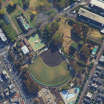
Transform this aerial map view into an illustrated aerial photograph captured from above. Create a vibrant, animated aesthetic with brilliant colors and scatter miniature figures throughout the scene for a whimsical, magazine-quality illustrated result.
Description
A prompt that converts Google Maps or Google Earth aerial screenshots into vibrant, whimsical cartoon-style drone photographs with tiny figures and magazine-quality illustration.
Prompt Parameters
ModelNano Banana Pro
Aspect Ratio2:3
Steps30
Guidance Scale7.0